Iron Sentinels of the North Sea: Inside the Haunting World of the Maunsell Sea Forts
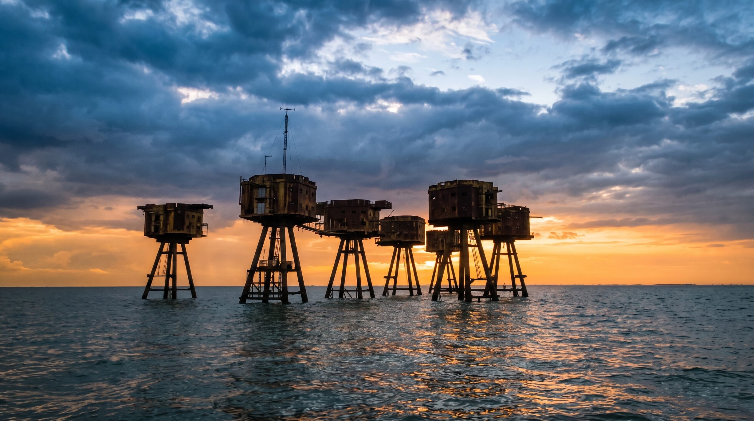
Rising from the grey water of the Thames Estuary like the skeletal legs of some enormous, rusting creature – angular, elevated, impossibly exposed: the Maunsell Sea Forts don’t look like history. They look like a fever dream. Like concept art for a film that never got made. Like something a dystopian architect sketched on a napkin in 1943 and somehow, impossibly, got approved.
They are real. They are still out there. And they have been standing in saltwater for over eighty years.
You see them before you understand them.
Today, the Maunsell Sea Forts are among Britain’s most extraordinary abandoned military landmarks, attracting historians, photographers, urban explorers, and dark tourism enthusiasts from around the world.
War Machines That Look Like the Future: The Most Unsettling Silhouette in British Waters
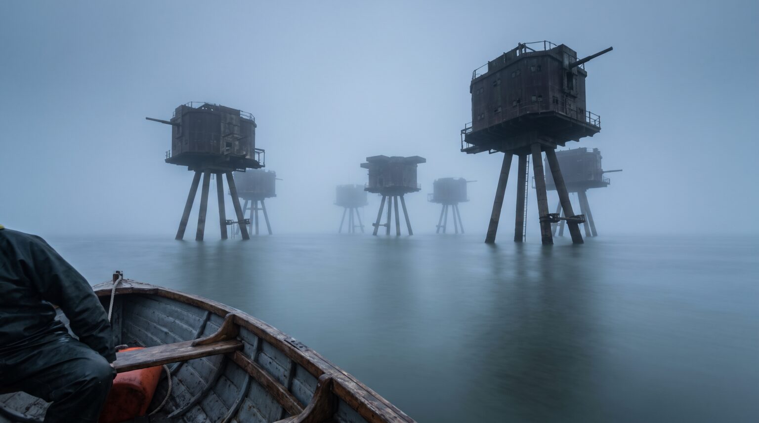
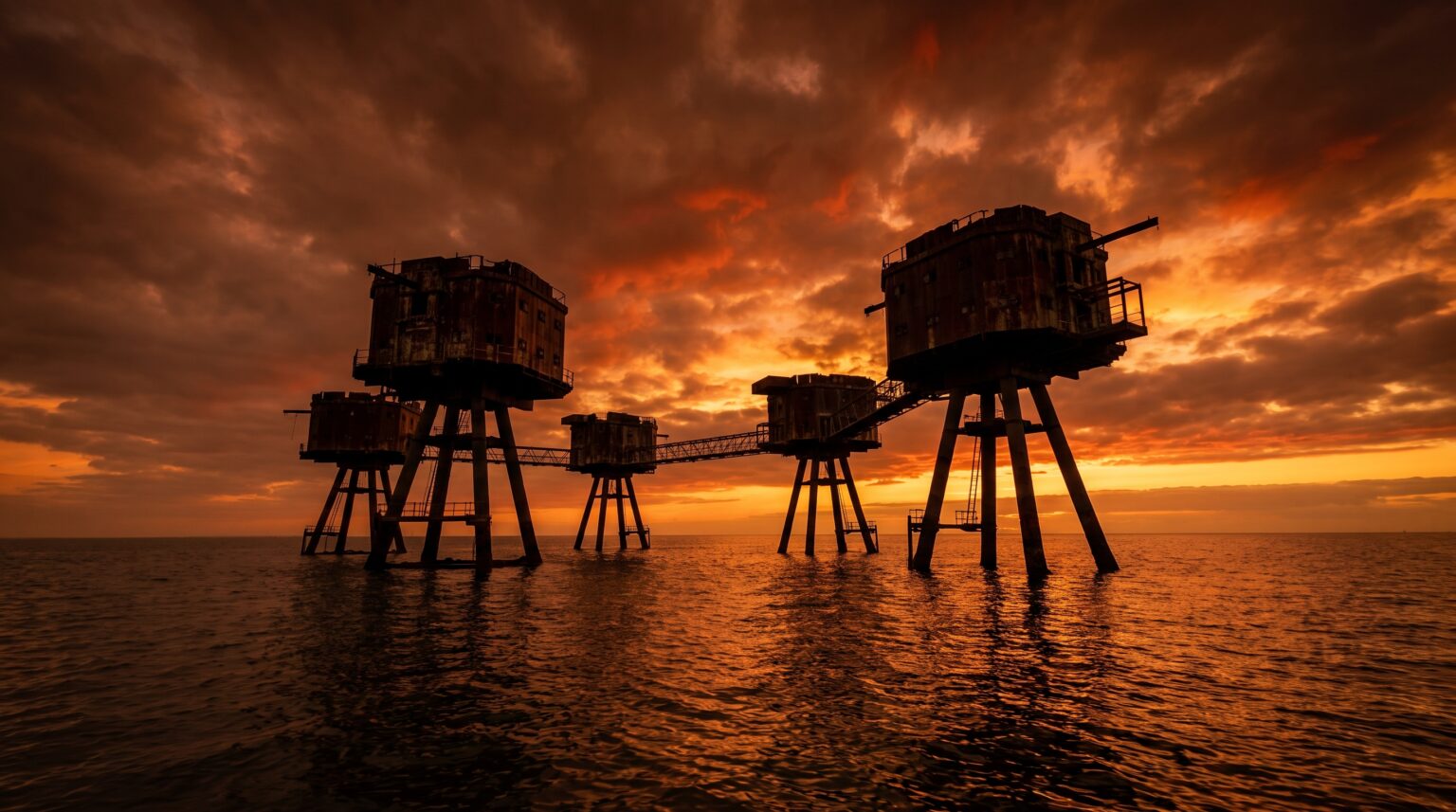
Stand on the deck of a boat in the estuary and watch them emerge through the sea mist. The platform legs. The elevated gun decks. The catwalk spines connecting tower to tower like the bones of something industrial and half-alive.
Your brain keeps reaching for a reference and finding the wrong ones – oil rig, space station, post-apocalyptic watchtower – because nothing in your peacetime visual library prepared you for what an offshore anti-aircraft fortress actually looks like up close.
These were not built to be beautiful. They were built to kill aircraft.
That gap between their intended brutality and their accidental visual poetry is the thing that makes the Maunsell forts so genuinely difficult to shake. One of them, Roughs Tower, became the territorial foundation for the Principality of Sealand, a self-declared micronation that still technically claims sovereignty over a WWII gun platform seven miles off the Suffolk coast. Others were commandeered by pirate radio operators in the 1960s, their anti-aircraft decks repurposed as broadcast towers for music the British government didn’t want its citizens to hear.
Anti-aircraft defense. Micronation. Pirate radio. All the same rusting steel legs.
A Civil Engineer, a War, and a Two-Month Deadline
Guy Maunsell, a civil engineer, had one problem and one very extreme solution.
Step back to 1940. The Battle of Britain is grinding through the summer sky. The Thames Estuary, gateway to London, artery of the Port of London, then the busiest port on earth, is under sustained pressure from German aircraft using it as a navigational corridor for bombing runs, mine-laying operations, and attacks on Allied shipping.
The sea approaches are too wide to defend from land. Too exposed for conventional fixed installations. Too strategically critical to leave unguarded.
Guy Anson Maunsell had an answer.
Maunsell was a civil engineer who had served in the Royal Engineers during World War I, a man who understood both the physics of large-scale construction and the organizational logic of military infrastructure. His proposal, surfaced in Thames Estuary, was audacious to the point of seeming unhinged: build the defensive platforms on land, float them out to position, and then deliberately sink them into the seabed so that only the operational towers remained above the waterline.
The Controller of the Navy accepted the design. Construction began in 1941.
The original projected build time was two months. Two months, in wartime, to fabricate permanent offshore military platforms capable of surviving tidal movement, saltwater exposure, North Sea winds, and sustained enemy attack. That number tells you everything about the pressure these structures were born under – and the industrial urgency that shaped every design decision that followed.
Two Fort Families, One Hostile Estuary
The forts came in two distinct configurations, built by two different branches of the military with two different threat priorities, and the difference between them is visible in every line of their surviving architecture.
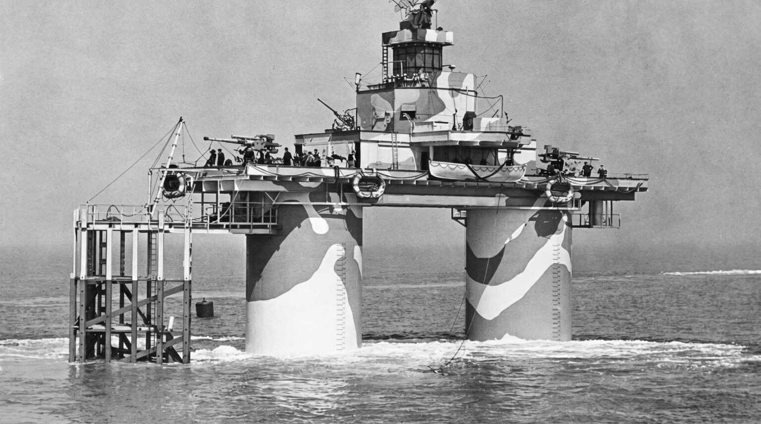
The Navy forts came first. Simpler. Two hollow cylindrical towers rising from a 51-metre pontoon base, towed to position, flooded until only the upper sections cleared the waterline. Each tower was subdivided internally into floors; crew accommodation, munitions storage, command functions, stacked vertically inside a steel cylinder being steadily corroded by the sea. A crew of around 120 men lived and worked inside these columns, suspended above open water, with no land visible in any direction.
The Army forts came later and went further.
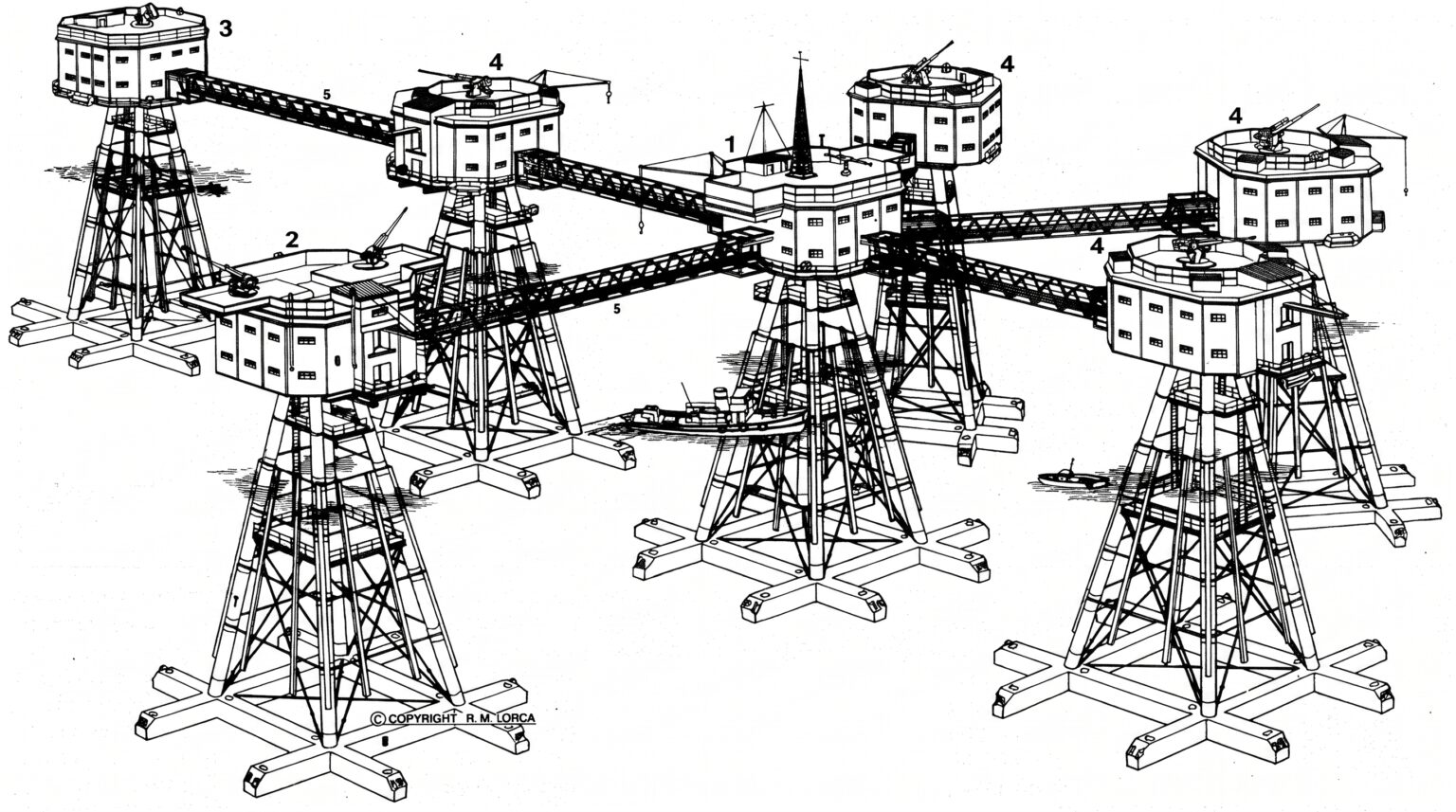
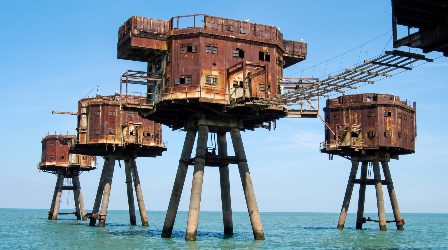
Where the Navy design was austere, the Army configuration was a system; multiple steel towers arranged in a defensive semicircle around a central control tower, connected by elevated walkways, each platform carrying a specific operational role. Gun towers. Searchlight towers. Bofors towers. The full array, seen from above, looks less like a military installation and more like a diagram of some alien colony module, each unit dependent on the others, the whole structure spreading across the water in a formation designed for overlapping fields of fire.
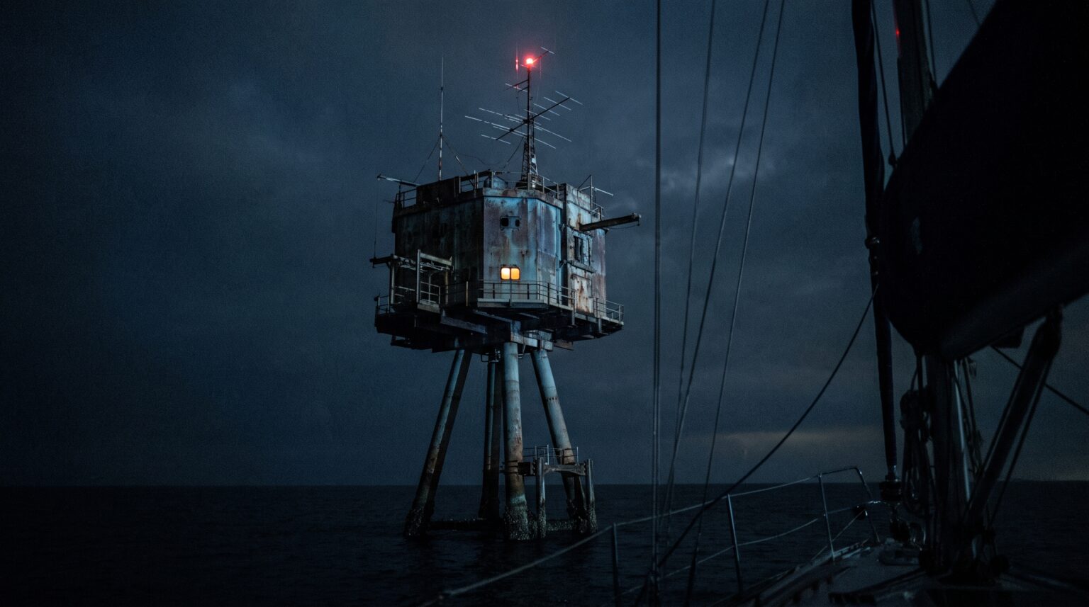
The Architecture of the Maunsell Sea Forts
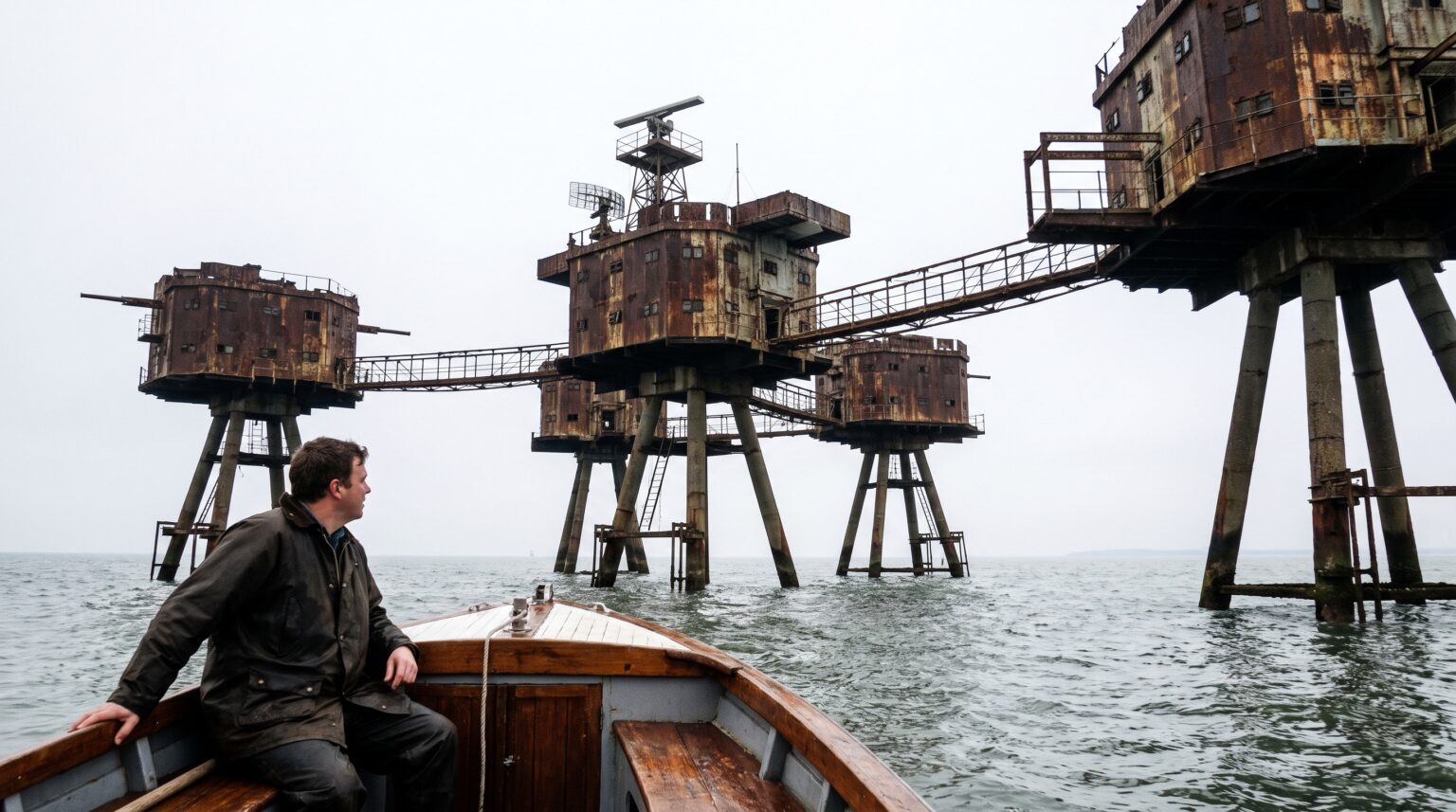
As you approach by boat, the scale resolves slowly. First the silhouette. Then the individual legs, concrete and steel columns disappearing into dark water, stained with decades of tide and rust in long, vertical streaks that run from waterline to gun deck like war paint. Then the catwalks. Exposed steel walkways connecting tower to tower, open to whatever the North Sea decides to send across on any given morning.
No glass. No shelter. No architectural gesture toward human comfort.
The gun decks sit at the top of it all, elevated, cantilevered, carrying the ghost geometry of QF 3.75-inch anti-aircraft guns and Bofors 40mm mounts that once tracked German aircraft across the estuary sky. In wartime configuration, the Thames forts collectively downed 22 aircraft, 30 flying bombs, and one German attack boat. Not abstract numbers. Real machines falling out of the real sky, into the real water you are floating on right now.
The forts earned their keep.
What remains of Red Sands, Shivering Sands, and Knock John, the best-known surviving Thames examples is not ruin in the soft, romantic sense. Ruin implies collapse, dissolution, nature softening the edges of human ambition. These structures refuse that narrative. They are corroded, yes. Salt-stripped. Stripped of every non-structural element. But the bones are still there, still severe, still rising from the water with the same uncompromising verticality they had when they were operational.
Nore was the one exception, the only fort built directly in place rather than floated out. It is gone now. The others remain.
The Material Logic of Surviving Eighty Years in the North Sea
Run your eye along the surviving structure and you are reading an engineering argument made in steel and reinforced concrete. Every choice was a calculation against the specific brutality of a tidal saltwater environment, heavy weather, constant spray, the slow chemical violence of corrosion working inward from every exposed surface simultaneously.
The pontoon foundations. The hollow cylindrical towers. The elevated platforms keeping critical systems above the worst of the wave action. These were not aesthetic decisions. They were survival decisions that happened to produce a visual language unlike anything else built in the twentieth century.
You look at a Maunsell fort and you see what happens when pure function, genuine wartime urgency, and offshore engineering collide without any of the usual moderating forces, budget comfort, aesthetic consideration, the luxury of time. The result is a structure so committed to its own logic that it accidentally became one of the most visually striking things standing in British waters.
Accidentally. That part matters.
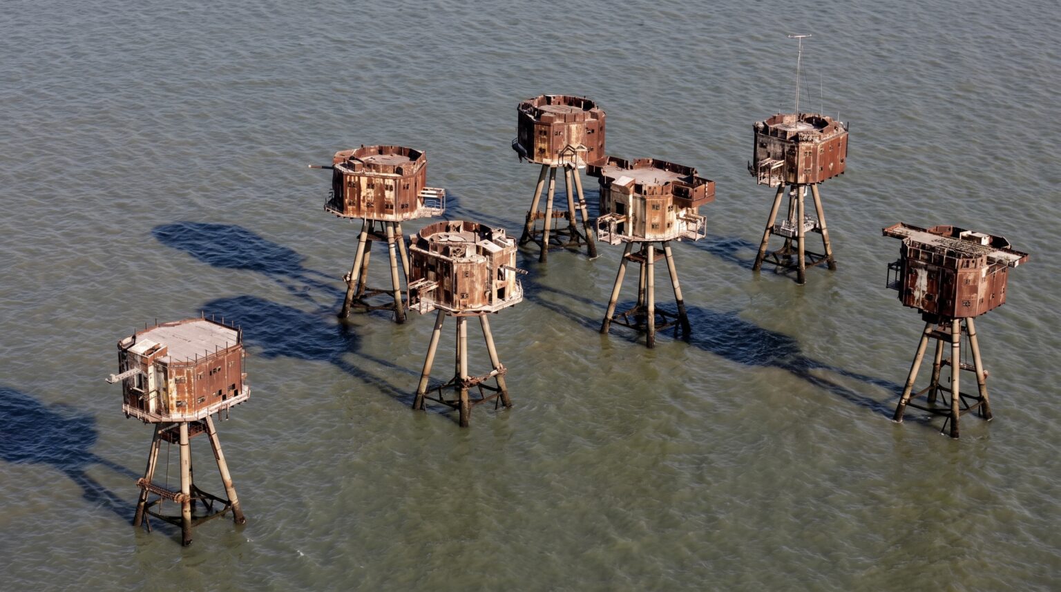
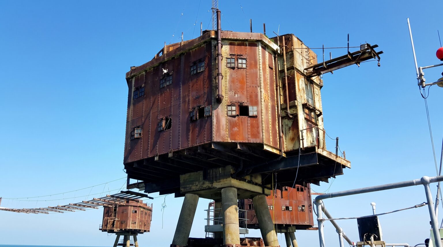
When the Sky Stopped Needing Them
The War Ended. The Forts Didn’t Know What to Do Next.
The decommissioning didn’t happen all at once. That’s the part that gets lost in the clean version of the story, the idea that one day the war ended and the next day the forts were abandoned, handed over to the gulls and the salt and the tides. The reality was slower, messier, and in several cases, genuinely violent.
The Mersey forts went first. Gone by 1955. Demolished cleanly, efficiently, with the same industrial logic that built them.
The Thames forts took longer to die, and some of them fought the process. Sunk Head was decommissioned in 1945, abandoned in 1956, and then, because abandonment wasn’t enough, because the offshore legal grey zone it occupied had started attracting the wrong kind of attention, deliberately blown up in 1967.
Tongue Sands lasted in a different way and decommissioned in 1945, quietly decaying through the 1949 abandonment, weakened by damage in 1947, further eroded through the 1960s, until a single storm in 1996 finished what fifty years of saltwater had started. One night of weather. Gone.
Nore had the most brutal exit of all.
A Norwegian Ship, a Storm, and the End of a Fort
Picture it: 1953, a storm batters Nore hard enough to cause serious structural compromise. The fort survives, technically. Then 1963 arrives, and a Norwegian vessel strikes it directly. A collision that kills four people aboard the ship and destroys equipment on the fort. The combined damage is too much. By 1959–1960, the dismantling is already underway. The physical remains get dumped near Cliffe. There is no standing structure. No wreck to photograph from a boat. Nothing to put on a map for the dark tourism itinerary.
Nore is just water now.
Shivering Sands took its own collision hit in 1963, a ship strike that brought one of its towers down into the estuary. Red Sands weathered the physical damage better than most, but weathering is its own slow violence: salt, corrosion, the constant tidal pull on every bolt and joint and catwalk connection, year after year after decade after decade with no maintenance crew, no paint, no structural intervention of any kind.
Radar Killed What the Luftwaffe Couldn’t
The deeper reason for the abandonment wasn’t the storms or the collisions. Those were symptoms. The real cause was that air warfare moved on and left the forts standing in water that had become strategically irrelevant.
Radar improved. Missiles arrived. Jets made the fixed-gun, fixed-platform, fixed-location model of anti-aircraft defense look like something from a different century; which, by the mid-1950s, it effectively was. You can’t retrain a static offshore tower to track a supersonic aircraft. You can’t retrofit a concrete cylinder with a surface-to-air missile system and pretend the geometry still works.
The forts had been built to solve a specific problem. The problem changed. They couldn’t.
What followed was the offshore legal vacuum that makes this story genuinely strange. The forts sat outside clear territorial jurisdiction. They were difficult to police. They were structurally still sound enough to occupy but officially owned by nobody with an active interest in what happened on them. Into that vacuum walked the pirate radio operators, the sovereignty dreamers, and eventually the most famous squatter in British maritime history.
Radio Waves, Rebel Frequencies, and One Man’s Kingdom
Knock John became Radio Essex in the late 1960s, a broadcast tower dressed in anti-aircraft steel, sending frequencies across the estuary that the British government couldn’t legally reach. Roughs Tower went further. First pirate radio. Then, in 1967, a former British army major named Paddy Roy Bates sailed out, claimed the platform, declared it a sovereign nation, named it Sealand, and issued himself a passport.
He was not joking.
The Principality of Sealand has its own flag, its own currency, its own nobility titles available for purchase online. It has defended itself, physically, against attempted takeovers. It was once in serious discussions with The Pirate Bay about hosting their servers inside its claimed jurisdiction, beyond the reach of intellectual property law. None of this is metaphor. A WWII anti-aircraft tower, seven miles off the Suffolk coast, became the world’s most unlikely geopolitical experiment, and it is still out there right now, still claimed, still flying its flag, still technically Sealand.
The forts didn’t just rust. They reinvented themselves.
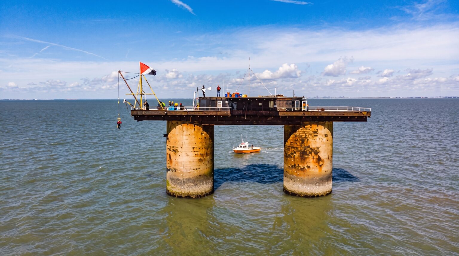
The Gritty Reality of Visiting the Maunsell Forts Today
Salt air, binoculars, and the art of watching from a distance.
Here is the thing about the Maunsell forts that no one tells you before you start planning: the visiting experience is fundamentally, irreducibly maritime. You are not walking to a ruin through a field. You are not finding a gap in a fence. The barrier between you and these structures is not a lock or a sign; it is the North Sea itself, and the North Sea does not negotiate.
Start with what is actually achievable.
Drive to Whitstable on the Kent coast. On a clear day, and it must be a clear day, you will know within five minutes of arriving whether the visibility is working for you or against you; Red Sands and Shivering Sands are visible from the shoreline. Tiny. Exact. Dark angular forms sitting on the horizon line where the estuary opens into open water, looking precisely like what they are: skeletal industrial structures that have been standing in that water since before your parents were born.
Bring binoculars. This is not optional.
What You Actually See, and What You Actually Feel
The shore view is not a consolation prize. Resist the instinct to dismiss it as second-best. There is something specific and unrepeatable about standing on a Kent beach with the wind coming in hard off the estuary, watching these structures through binoculars, understanding that you are looking at the same silhouette that German pilots saw from the opposite direction in 1943 – that those gun decks up there were tracking aircraft moving at speed through the sky directly above where you are standing right now.
That context makes the distance feel intentional rather than frustrating.
For closer approach, the legitimate path is a professionally run boat tour operators who work the Thames Estuary with the appropriate permissions, safety equipment, and awareness of tidal conditions around the fort legs. These are not tourist cruises in the conventional sense. The estuary is not a marina. The water around the forts moves with tidal logic that has nothing to do with how convenient your schedule is, and the vertical sections between the waterline and the gun decks are corroded steel with no safe civilian access route.
You look up at it from the water. That’s the experience. That’s enough.
Red Sands: The Fort That Preservation Didn’t Quite Save
Red Sands is the one to focus your logistics around. Project Redsand; the preservation initiative that has spent years and real money trying to stabilize and document the fort has at times arranged permission-based access, with an initial access system that reportedly cost around £40,000 to install. The Port of London Authority has conducted underwater surveys. There is genuine institutional energy around this structure.
It is still not open for casual landing. Not safely. Not routinely.
The corrosion is not decorative. The catwalks that look so dramatically photogenic from a boat are the same catwalks that have been absorbing saltwater and tidal spray continuously since 1942. Every surface you would want to stand on has been doing its slow structural arithmetic for eighty years, and the math does not always favour the weight of a visiting human being with a camera bag and no engineering assessment in hand.
Watch the Project Redsand channels. Sign up for updates. When permission-based visits are arranged, they are announced, limited, and filled quickly.
Your Kit List and Your Honest Expectations
The gear reality for the Maunsell forts is simpler than most people expect, because the main barrier is not equipment, it is access and sea conditions, neither of which you can pack your way out of.
For shore viewing: windproof, waterproof outer layers, because the Kent coast in any season outside midsummer will remind you immediately that you are standing on the edge of a tidal estuary and not a Mediterranean promenade. Binoculars with at least 10x magnification. A camera with a telephoto lens if you want images worth keeping from the shoreline, phone cameras will give you grey water and a vague dark smudge, which is technically accurate but emotionally unsatisfying.
For boat approach; defer entirely to your operator on safety requirements. Marine-grade waterproofs, non-slip footwear, and the psychological willingness to accept that sea conditions may change the plan on the morning of departure. The Thames Estuary is not a controlled environment. It has never been interested in your itinerary.
The Last Thing You Need to Know Before You Go to Maunsell sea forts
Sealand is not a tourist destination. Roughs Tower, the Navy fort that became the Principality is still controlled by the Bates family and their successors. Access is their decision, not yours, and it is not something you arrange through a standard booking system. It is legally and practically a world apart from Red Sands or Shivering Sands, and the people who run it treat it accordingly.
Knock John stands. Shivering Sands stands. Red Sands stands.
Nore is water. Sunk Head is memory. Tongue Sands collapsed on a winter night in 1996 while nobody was watching, and took whatever remained of its wartime story down with it into the estuary.
The forts that survive do so against the full weight of the North Sea‘s indifference against corrosion and collision and governmental neglect and the simple, patient destruction of time applied to steel and concrete in a saltwater environment. They are still there. Skeletal. Rust-streaked. Elevated above tides that have been working on their foundations every six hours without interruption for eight decades.
You do not need to touch them to understand what they mean.
You just need to see them once, from the water, with the wind in your face and the scale of the estuary around you, to understand exactly what it cost to build them and exactly why the sea is slowly, inevitably, winning.
The Final Verdict on the Maunsell Sea Forts
Some things built for war develop a second life that the war could never have predicted. A gun platform becomes a radio tower. A radio tower becomes a nation. A nation becomes an internet legend. And somewhere underneath all of that reinvention, the original structure, the steel, the concrete, the pontoon legs disappearing into tidal water, just keeps standing, indifferent to every story being told about it.
That is the Maunsell Sea Forts. All of them, simultaneously.
They were conceived in urgency and built in two months and credited with bringing down 22 aircraft and 30 flying bombs and one German attack boat, and then the war ended and the air defense doctrine changed and radar made them redundant and the sea started its slow, patient, entirely impersonal project of reclaiming them. Some went quietly. Nore went violently. Tongue Sands went on a winter night in 1996 when a storm finished what fifty years of saltwater had started. Sunk Head was blown up deliberately, because even abandonment felt insufficient.
The ones that survived did so without asking permission.
Red Sands is still out there, rust-streaked and skeletal, the subject of preservation efforts that cost real money and produce real results and still cannot make the structure safe enough for casual visitors. Shivering Sands stands with a tower missing, the ghost geometry of its 1963 collision still visible in the gap where a platform used to be. Knock John stands. Roughs Tower stands, flying the Sealand flag, the most improbable territorial claim in the North Sea, the punchline to a geopolitical joke that somehow became real and stayed real for sixty years and counting.
What these structures represent, taken together, is something genuinely rare in the catalogue of abandoned places. Not just a ruin. Not just a wartime artifact. A complete arc from military necessity to postwar redundancy to pirate insurgency to sovereignty fantasy to heritage object, compressed into steel and concrete that was only ever supposed to last long enough to see the war through.
It lasted eighty years. It is still lasting.
The question that follows you home from the Kent shoreline, binoculars still in your bag, the estuary wind still in your jacket, is this: when the last Maunsell fort finally goes, when the final storm finds the final structural failure in the final corroded joint – will anyone be watching, or will it slip into the water the same way Tongue Sands did, quietly, at night, with the sea closing over it like it was never there at all?
Bookmark and subscribe to roastedbum.com to get more updates on astonishing historical deep dives.